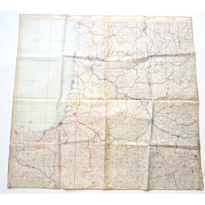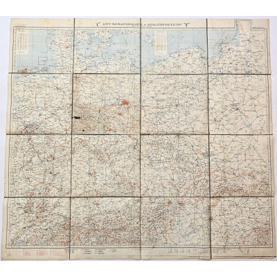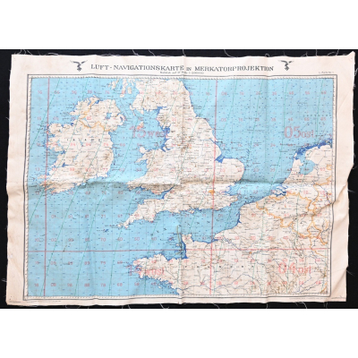
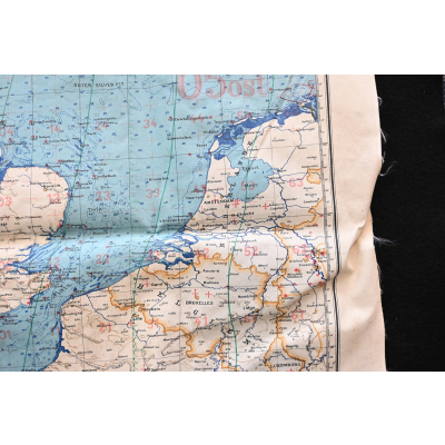
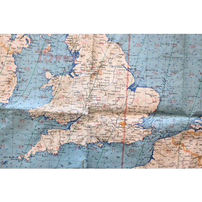

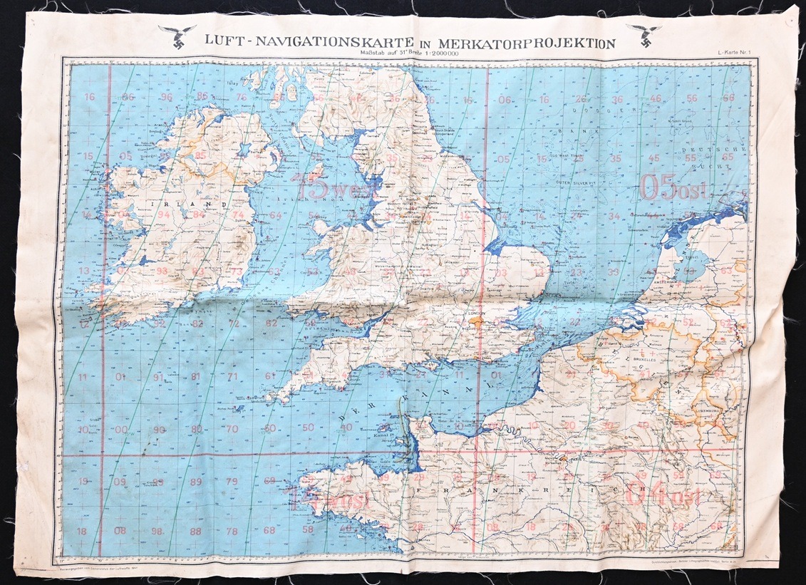
Luftwaffe Navigation Map 1941 (England/NL)
SOLD
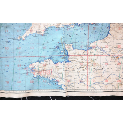
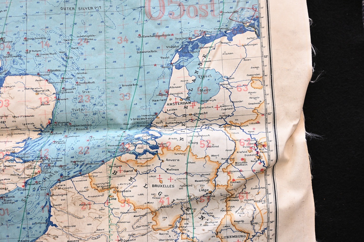
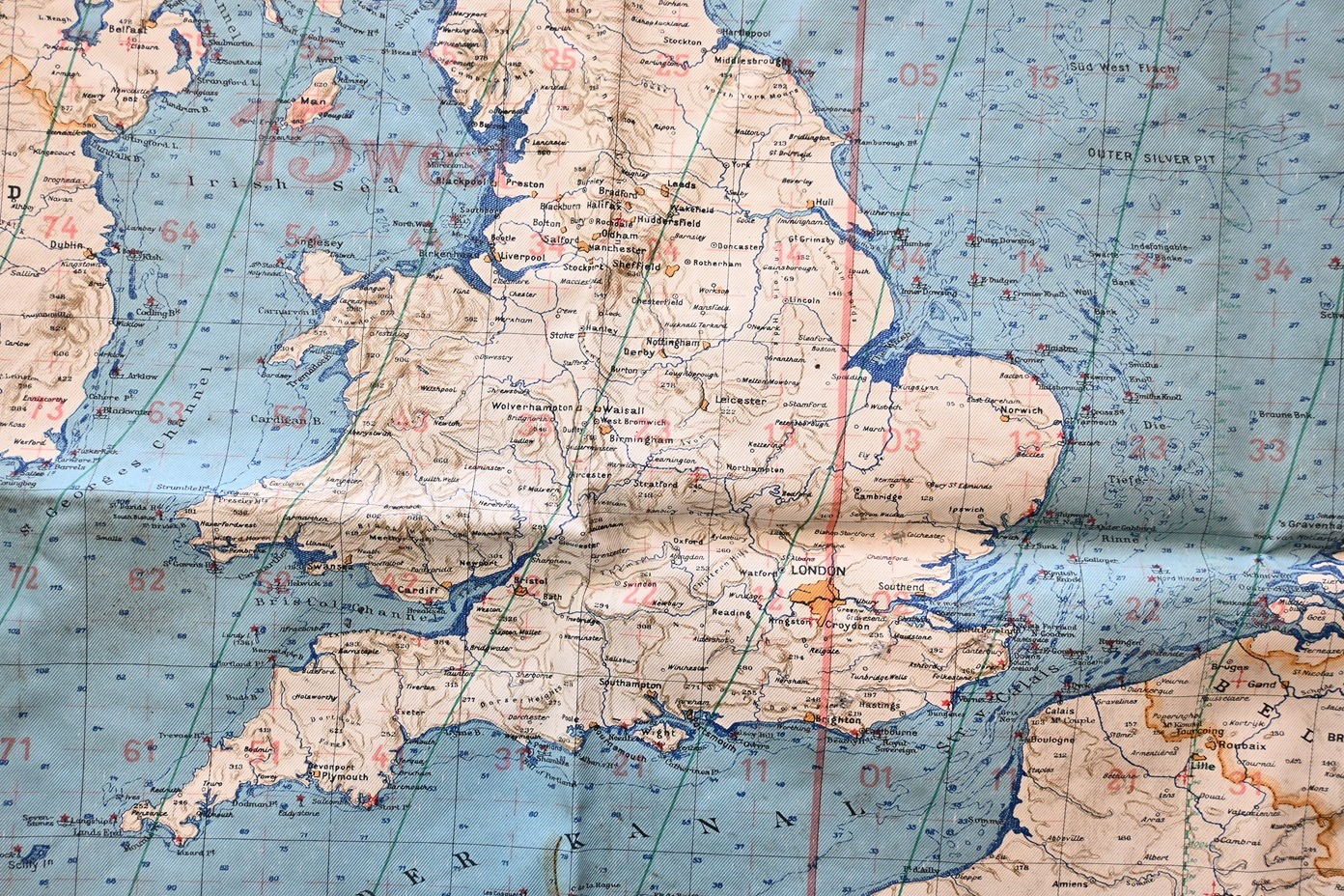
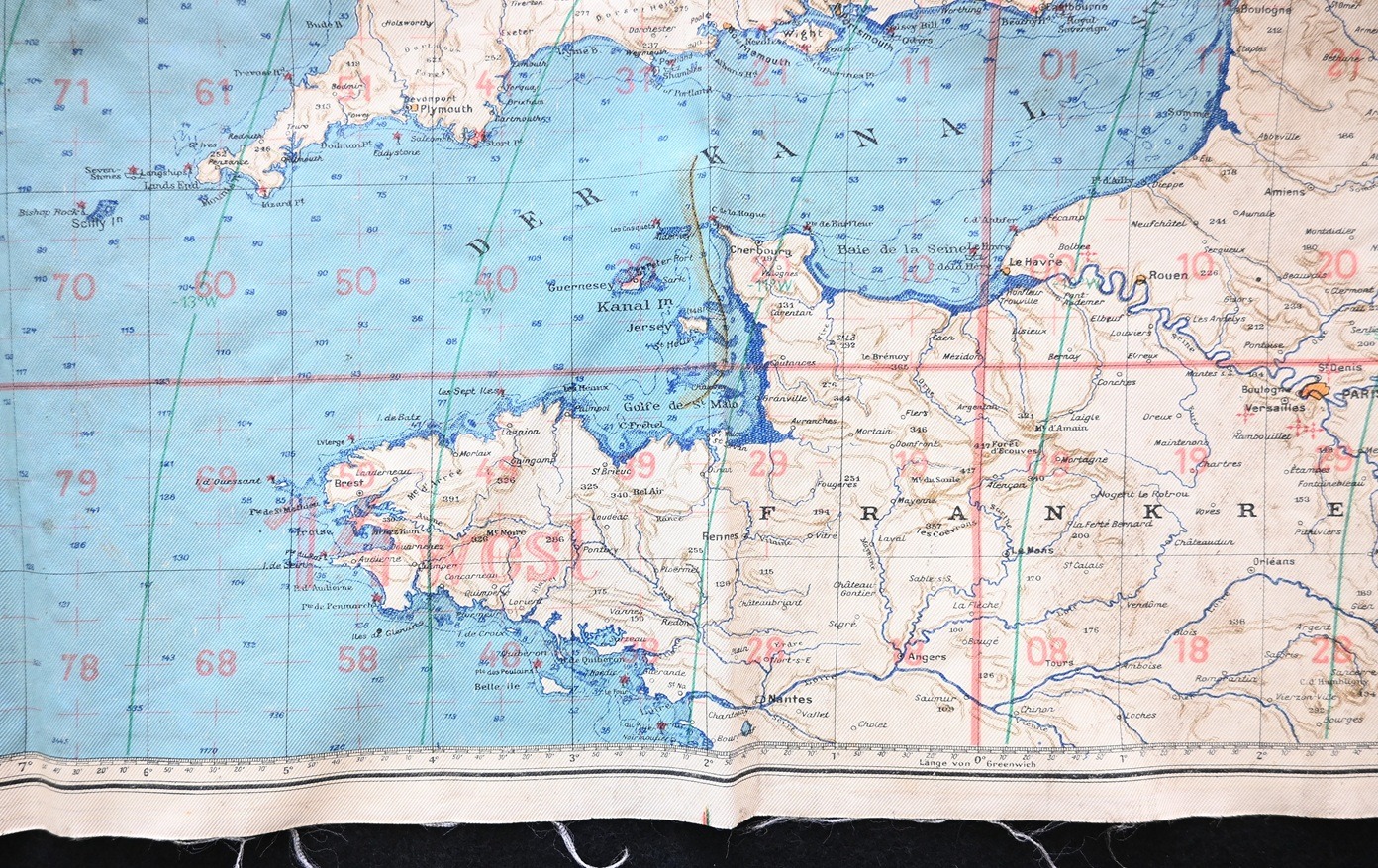
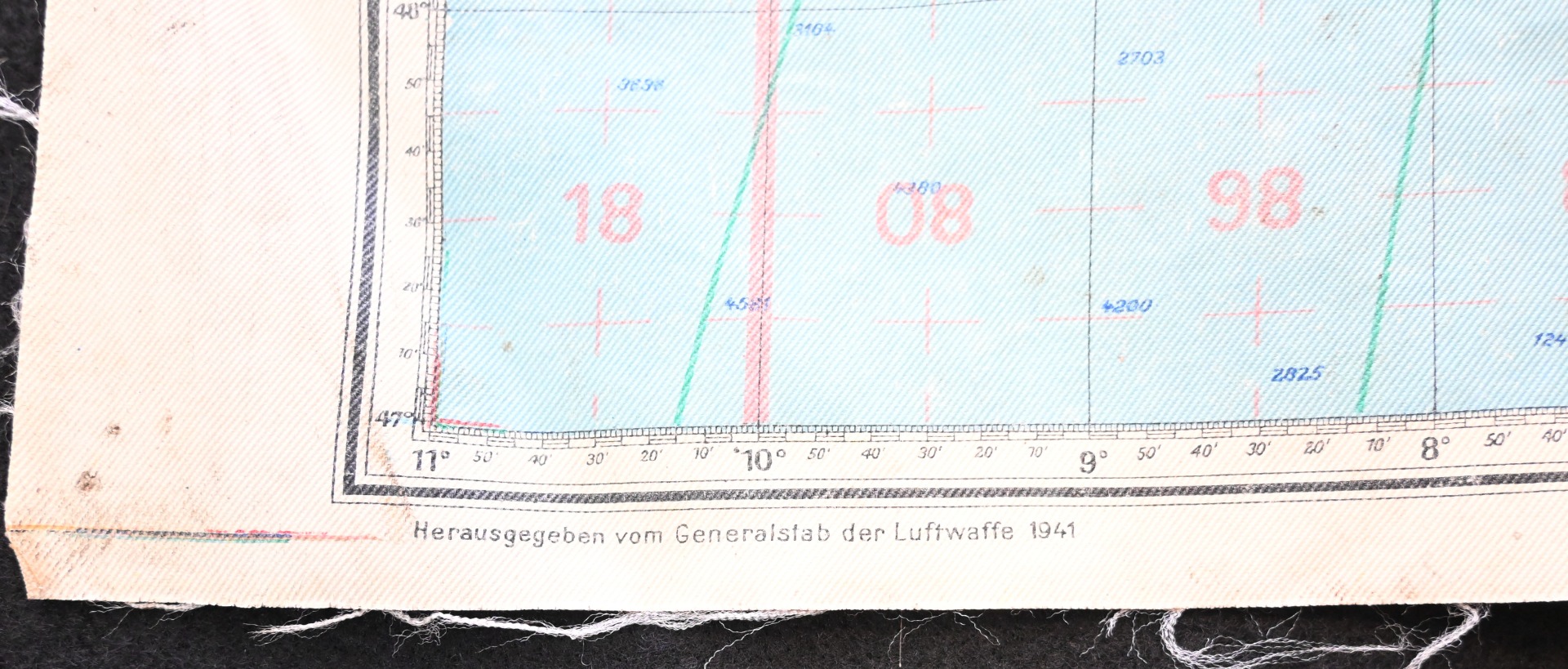
Very nice Luft-Navigationkarte of England, the Netherlands and the French coast.
Availability:Out of stock
Product Number
30204
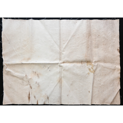
The map shows overall normal signs of wear. It's made out of water resistanced oil cloth. It shows the whole of England, the Netherlands, Belgium and the west coast of France (Normandy). The map measures approx 72cms*53cms. Dated 1941.
| Product Number | 30204 |
|---|---|
| Weight | 0.125000 |
| branch | Luftwaffe |
| Unit: | Piece |